15 to 17 Oct - A short trip down south
Waiting in Perth for our spare parts to arrive in the mail became frustrating so we decided to take a short trip south. We took the train to Mandurah and we explored what I remembered of the bushland between Perth and Bunbury. Unfortunately in the decades since my childhood and today much of the land has been converted into housing estates - however if you look carefully there are still good things to see.
Thu 22 Oct - John Forrest National Park
Eventually our bike parts arrived and we were able to depart.
Due to time constraints (and because we've not been this way before) we decided to head east towards Kalgoolie rather than south towards Albany.
.
We took the train to Midland and joined the Heritage railtrail from Midland, through John Forrest National Park to Woorloo. This railtrail takes two old railway routes to create a Midland, Chidlow, Midland cycling loop that is well worth visiting. The trail also continues north east between Chidlow and Woorloo but this less used section is a little softer than the main cycling loop - easily navigable but a bit challenging if you riding with a tour load. We elected to ride on the quiet roads that follow the former rail reserve.
Waiting in Perth for our spare parts to arrive in the mail became frustrating so we decided to take a short trip south. We took the train to Mandurah and we explored what I remembered of the bushland between Perth and Bunbury. Unfortunately in the decades since my childhood and today much of the land has been converted into housing estates - however if you look carefully there are still good things to see.
 |
| Sunset over Peel Inlet |
 |
| Thrombolites - cyanobacteria colonies responsible for oxygenating the planet. Lake Clifton |
 |
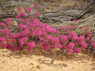
| Banksia in flower. The banksia woodland vegetation community feels homely to me. |
Thu 22 Oct - John Forrest National Park
Eventually our bike parts arrived and we were able to depart.
Due to time constraints (and because we've not been this way before) we decided to head east towards Kalgoolie rather than south towards Albany.
.
We took the train to Midland and joined the Heritage railtrail from Midland, through John Forrest National Park to Woorloo. This railtrail takes two old railway routes to create a Midland, Chidlow, Midland cycling loop that is well worth visiting. The trail also continues north east between Chidlow and Woorloo but this less used section is a little softer than the main cycling loop - easily navigable but a bit challenging if you riding with a tour load. We elected to ride on the quiet roads that follow the former rail reserve.
 |
| Xanthorrhoea - thriving following recent fires in John Forrest National Park |
 |
| Rail tunnel in John Forrest National Park built in the C19th and until they built the Perth City underground in early C21st the only tunnel on the Perth railway network |
 |
| A red tailed black cockatoo |
 |
| Kangaroo Paw in full bloom |
Friday 23 Oct Goomelling
There are two main ways out of Perth heading East. The first is the Great Eastern Highway - which takes you to either Northam or York. The second heads north east via the Swan - Avon river valley to Toodyay. Both are busy undulating roads. Of the two Great Eastern is the busier and better made.
Toodyay Road is an undulating stripe of bitumen with double white lines and a narrow loose pea gravel shoulder. Riding it a hairy experience that requires one eye on the road ahead and another in the rear vision mirror. We were frequently veering off the road and into the loose gravel to avoid grain trucks as they thundered upon us. Maintaining control of the bike as you hit loose gravel at speed is really challenging.
I had my first stack of the ride on Toodyay Road. One of my panniers worked loose on a downhill run and it looked like it would fall off. I grabbed a handful of brakes and pulled off the road. As my wheels locked up and hit loose gravel the bike slipped out from under me and I went over the handlebars. My shoulder and hands took most of the blow but overall the stack was a minor one.
We took the first opportunity possible to leave Toodyay Road, opting instead for a "Pioneer's scenic route" - a gravel road that followed the river and railway.
There are two main ways out of Perth heading East. The first is the Great Eastern Highway - which takes you to either Northam or York. The second heads north east via the Swan - Avon river valley to Toodyay. Both are busy undulating roads. Of the two Great Eastern is the busier and better made.
Toodyay Road is an undulating stripe of bitumen with double white lines and a narrow loose pea gravel shoulder. Riding it a hairy experience that requires one eye on the road ahead and another in the rear vision mirror. We were frequently veering off the road and into the loose gravel to avoid grain trucks as they thundered upon us. Maintaining control of the bike as you hit loose gravel at speed is really challenging.
I had my first stack of the ride on Toodyay Road. One of my panniers worked loose on a downhill run and it looked like it would fall off. I grabbed a handful of brakes and pulled off the road. As my wheels locked up and hit loose gravel the bike slipped out from under me and I went over the handlebars. My shoulder and hands took most of the blow but overall the stack was a minor one.
 |
| The stack tore open the shoulder of my shirt. I pretty much had to reconstruct it. |
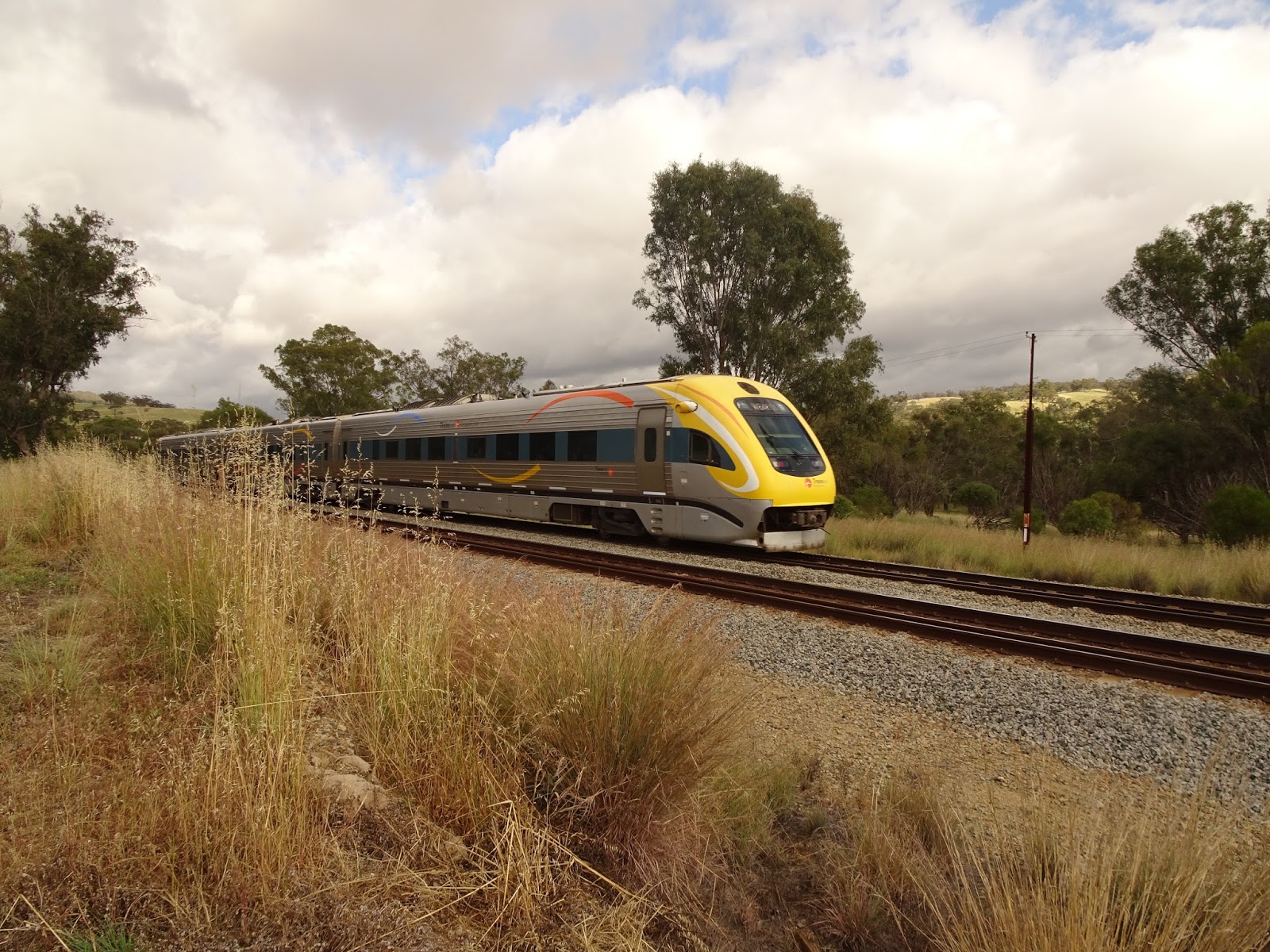 |
| The Prospector makes its way East |
At Toodyay bakery we found a lovely bakery with a first floor dining area where we ate some very reasonably priced and giant sized pastries. It seems "Perth prices' only apply to the city. The FIFO price premium that appears to apply to takeaway food doesn't extend into the country.
 |
| An Australian Ring Necked Parrot (aka Twenty Eight Parrot) joined us for lunch |
 |
| The Goomelling Grain Silos are space age looking domes. |
 |
| A big monitor lizard warms itself on the pavers as we enjoy afternoon tea. |
Sat 24 Oct White Man's Rock
We are in wheatbelt country now and for kilometres of our ride we pass fields of ready to harvest wheat yellowing in the sun. People who regularly drive through the wheatbelt had suggested the countryside could get a bit monotonous but at cycling speed I found plenty of small scale variety to keep interested. Throughout the day we passed small patches of remnant bushland, granite outcroppings other points of interest in the sea of grain. Those fragments of bush included some wonderful wild flowers.


The farms were established before widespread car ownership and it shows in the spacing of the towns. The settlements are between 20 and 40 kilometres apart - about as far as a person can travel in a day with a horse or ox drawn cart. The result is very comfortable riding conditions, and a town for every meal break. Unfortunately car ownership is near universal, these towns are losing their reason for being as locals dive to larger towns like Merredin for the weekly shop.
We stopped at Dowerin for breakfast at a bakery - and enjoyed a chocolate bar in a shaded seating area overgrown with a creeper. It made the place look like a bird hide, and it as a good spot to watch the goings on of the main street without being pulled in to the "what you riding a bike for?' conversation.
At Wyalkatchem we stopped for lunch at the pub, and it being after 12 on a Saturday it was the only place open. (WA takes its trading hours seriously, The shops are pretty much closed from middeay Saturday to 8am Monday).
At Trayning we enjoyed an afternoon tea in front of the English, Scottish and Australian Bank (I thought that sounded like the set up to a bad joke. Maree disagreed).
On the road between Wyalkatchem and Trayning we found trees ripe with quondongs. We pulled over and and sampled a few of these bright red balls of sour deliciousness.
Our campsite was a granite outcropping just north of Trayning called White Mans Rock. It took a little longer than expected to get there but we got some great sunset photos along the way.
We are in wheatbelt country now and for kilometres of our ride we pass fields of ready to harvest wheat yellowing in the sun. People who regularly drive through the wheatbelt had suggested the countryside could get a bit monotonous but at cycling speed I found plenty of small scale variety to keep interested. Throughout the day we passed small patches of remnant bushland, granite outcroppings other points of interest in the sea of grain. Those fragments of bush included some wonderful wild flowers.


We stopped at Dowerin for breakfast at a bakery - and enjoyed a chocolate bar in a shaded seating area overgrown with a creeper. It made the place look like a bird hide, and it as a good spot to watch the goings on of the main street without being pulled in to the "what you riding a bike for?' conversation.
At Wyalkatchem we stopped for lunch at the pub, and it being after 12 on a Saturday it was the only place open. (WA takes its trading hours seriously, The shops are pretty much closed from middeay Saturday to 8am Monday).
At Trayning we enjoyed an afternoon tea in front of the English, Scottish and Australian Bank (I thought that sounded like the set up to a bad joke. Maree disagreed).
On the road between Wyalkatchem and Trayning we found trees ripe with quondongs. We pulled over and and sampled a few of these bright red balls of sour deliciousness.
Our campsite was a granite outcropping just north of Trayning called White Mans Rock. It took a little longer than expected to get there but we got some great sunset photos along the way.
 |
| Quondong |
 |
| The Quondong tree |
 |
| Kamgaroos loose in the top paddock - This Euro didn't much care about the farmers wheat. |


Sun 25 Oct Mukinbudin
Today was a difficult day of riding. The wind blowing strong from the east and we had headwinds all day. We were both cranky about it and barely said a word to each other all day.
The we are reaching the more marginal parts of the wheatbelt - the land where it transitions into the goldfields - and localities that were not established until the soldier settlement scheme. It is beautiful country but not a good place to grow wheat. We passed several salt lakes and several townships were abandoned. The scheme to turn crown land into farms might have been popular politically, but didn't work environmentally or commercially.
.
 |
| Gnamma Hole - these granite formations create natural water holes throughout the wheatbelt. |
The Noongar creation time story about these waterholes involves an echidna who wandered throughout the wheatbelt country digging these holes as she rested. These rock hole water supplies were one of the more reliable water sources in this country - so needless to say they are places of intense cultural significance.


The strong winds brought heavy cloud and the signs of a thunder storm. Around four and as we approached 100km for the day the clouds started looking particularly nasty and we pulled off the road to make camp. The ground was hard making it impossible to drive in pegs so we used our panniers as corner weights instead. Shortly after pitching the tent the rains started. Heavy globs of driving rain hammered the nylon fly as we huddled and watched flashes of lightening strobe around us.
.
 |
| Thunderstorm is coming. We got the tent up just in time. |
Mon 26 Oct - Bullfinch and Southern Cross
We survived the thunderstorm but as we rode the next day we surveyed the damage. Strong winds had brought down trees. Every low point in the ground was now a small pool and the croaking of frogs provided a soundtrack for our ride into the first town of the goldfields, Bullfinch.
Bullfinch was tiny locality. A pained car bonnet declared it a town of 35 people + Larry. It was also the end of our quiet backroads alternative to Great Eastern Highway. Our last leg of the day took us to Southern Cross, and from there the only road east was the main drag.
My mum works throughout the wheatbelt and she suggested the Goomelling to Bullfinch route as a place of scenic beauty and an alternative to the Great Eastern Highway. I happily pass on that recommendation to my fellow bike tourists..
 |
| Trees lost branches in the thunderstorm and blocked the road. |


 |
| One last look at the flat fields of grain that give this district its name. |
 |
| Shingle back (aka bobtailed) lizard |
Tue 29 Oct - The Pipe
At Southern Cross we got a weather report. It showed a high pressure system in the bight, meaning anti-clockwise winds (easterlies). In addition to riding the main drag we had several days of headwinds ahead. Not so fun.
Great Eastern Highway is the main (and only) road between Southern Cross and Kalgoolie. It attracts significant truck traffic - a mix of oversized vehicles hauling mining equipment and road trains hauling general freight on the direct east-west route between Perth and the eastern states. There's also a smattering of caravan traffic, but nothing like the convoys of caravans we saw on the Stuart Highway..
The highway passes through the Yellowdine Nature Reserve and Boorabbin National Parks, and there's plenty of 'big sky views' across the mallee. The goldfields pipeline follows the highway and there are several pumping station rest areas to check out. We didn't. Between the trucks and the headwinds we adopted a 'get it done' attitude and we each rode to our own pace (with Maree way in front this time).
In the late afternoon the sky clouded over again and threatened to thunderstorm. This time the rain and thunder fell to the east of us. As the sun went down we watched the horizon light up as lightening danced off in the distance. It was quite a show.


 |
| A roadside memorial to three truck drivers who attempted to outrun a bushfire. |
When we pitched camp I realised I'd done something really dumb when we were in Southern Cross. I had put my SPOT tracking beacon in the garden to send a "I've safely made camp" message, but I hadn't collected it after the message was sent. I had left my emergency beacon in the Southern Cross Caravan Park. Fortunately I was able to call the park and ask for it to be mailed to me in Kalgoolie. Fingers crossed we will soon be reunited.
Wed 28 Oct - Coolgardie
Riding Great Eastern Highway into a headwind is one of those things you need to do to reach your destination. My knees hurt.

Thu 29 Oct - Kalgoolie
Kalgoolie is a major city. I expected a big town, but this is a small city - with traffic to match.
We rest here for two days Thursday and Friday, and then depart Saturday for the Nullabor.
We rest here for two days Thursday and Friday, and then depart Saturday for the Nullabor.
No comments:
Post a Comment